Saturday, June 11, 2016

Spring Mtn. Pass

 We're creating a blog post specifically for this portion of the route for our June 2016 Road Trip.  We're calling this route "Spring Mountain Pass".  It is not named Spring Mtn. Pass on any map but it seems logical to call it that.  The route comes up out of Sawmill Canyon on Squaw Creek, tops out on Spring Mtn. at 10,000 feet and then drops steeply down into Spring Mountain Canyon.

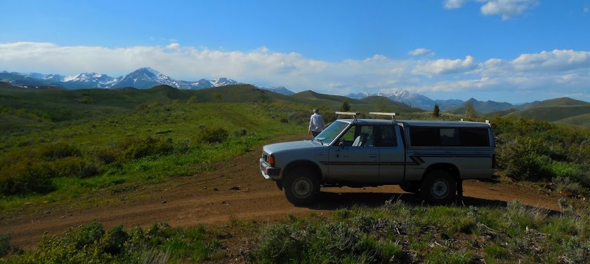
We found this route in the book "Backcountry Roads Idaho." It's on Pages 181-184. Anyway, the authors of that book use really goofy GPS coordinates that area difficult to decipher and translate into the coordinate system we use.  There's NO way we want to become confused, disoriented or (gawd forbid) downright lost on this route.  Hence, we are studying it intensively and will eventually make color prints of each component of the routing.  Red lines and red dots indicate the route.

We use two formats here--one is "x-large" and the other is "original size."  It's easier to look at the details in the original size graphics.

This is an old topo map but it actually shows the details better than either  Google Earth or Google Maps.


Interesting report on The Spring Mountain Mine

http://www.idahogeology.org/PDF/Staff_Reports_(S)/1999/S-99-5.pdf

There must be some pretty complex geology going on up there!

This is definitely not an encouraging review of that road!

http://www.idahoaclimbingguide.com/spring-mountain-road-system/


Spring Mountain Canyon sure sounds interesting!

EPISODIC PINEDALE GLACIER RETREAT, SPRING MOUNTAIN CANYON, LEMHI RANGE, EAST-CENTRAL IDAHO

O'CONNELL, James J., Geography, Univ of Kansas, 1475 Jayhawk Blvd, Lawrence, KS 66045, jjcorover@aol.com and DORT, Wakefield Jr, Geology, Univ of Kansas, 1475 Jayhawk Blvd, Lawrence, KS 66045On the eastern flank of the Lemhi Range, Spring Mountain Canyon has an especially detailed record of retreat of its Pinedale glacier. The half-mile-wide canyon floor has an over-all gradient of about 450 feet per mile from the base of the cirque headwall at 9400 feet to the canyon-mouth alluvial fan apex at 7400 feet. Several steps, both bedrock and moraine, punctuate the longitudinal profile. Narrow cirques of the main canyon and its tributary, Horseshoe Gulch, cut deeply into the sheltering main divide that rises above l0,400 feet.
Late Pleistocene and Holocene aridity permitted remarkable preservation of even minor moraines, both straight segments and loops; deglacial meltwater was scarce. Within the lower half of the main canyon 60 mappable moraine segments were delineated, 43 in the upper half, but only l4 in steeper Horseshoe Gulch. Most of the deposits lie on the northerly side of the valley where melting was concentrated, the southerly side being generally in shadow. Based on conservative interpretation of cross-cutting and over-riding relationships of moraine segments, 6 readvances are identified in the lower canyon and at least 7 in the upper canyon. Numerous stillstands are also indicated.

A real nice climbing report from the area:

http://www.supertopo.com/climbers-forum/2187170/How-to-hike-3-10-000-Ft-Peaks-in-a-day-I-had-to-be-high

Looks like it would be worth the trip just to climb Big Windy!

http://www.idahoaclimbingguide.com/bookupdates/big-windy-peak/

Blog Status

This blog is rarely used.  Ignore all previous posts.

Sunday, March 8, 2015

Road Trip Blog reawakens

Looking grim for getting to the Upper Ruin.  Monday's tour is filled and they don't give tours on Tuesday and Wednesday.

This blog has been dormant since January 2013. We're bringing it back to life for an early March Wild Flower Road Trip. The general idea is to head over to Payson Sunday and spend some Quality Time in Wal-Mart. Really?  Yep, we need to do some riggin' for how Sharlot carries our camping gear. Plus, we need to restock our chuck box.


After we're fully rigged, we will head down to Roosevelt and get a camp there. Hopefully, we'll be able to get on the Upper Ruin tour Monday. If not, we'll take whatever day we can get. Then we're heading to Globe to visit Dear Friends. After that, we're heading out to Peridot Mesa on the San Carlos Rez to search for a rumored vast field of poppies. Chances are we'll veer down to the Old Pueblo while keeping an eye on the various intel reports on Arizona wild flowers.


Here's some of the intel links:

http://www.dbg.org/gardening-horticulture/wildflower-infosite

http://wildinarizona.com/wordpress/

http://www.desertusa.com/wildflo/az.html

http://www.arizonensis.org/sonoran/sonoranwildflowers.html

http://archive.azcentral.com/travel/articles/20130128places-spring-wildflowers.html

Rigged

The first time we rig a new truck, it's always like solving a brand new jig saw puzzle.  We have good idea of how to begin and we always have high hopes on how it will end.  This time around, we got a pretty good idea of our "working space" by studying the truck online before we actually had it in our possession.

We also happened already have some sets of modular plastic boxes. We hoped they would fit and they did.  Anyway, the truck is all packed now at 12:30 pm.  We will probably drive out of here about 1:30-2 pm.  There's no hurry, we're only going to Windy Point Campground on Roosevelt Lake near Tonto, Arizona.  As long as we get there by about 5 pm, we should have plenty of time to set up camp.  (Narrative continues below photo.)

In the Photo Module #1 is the camp and sleeping set up.  Module #2 (three boxes) is the kitchen set up.  Module #3 is our personal clothes and stuff. J for John and S for Susun.  The blue bucket holds the propane tank and become a gray water slop bucket in camp.  Module #4 is our hiking stuff and Module #5 is obviously a cooler containing the typical cooler kinda stuff.  A bungee cargo net will go over the top of everything.

First In, Last Out

The very first thing we pack for a Road Trip is our "Home On The Road."  For this trip that means a tent and all of what tenting entails: sleeping bags, pads, pillows, groundsheets, etc. etc. etc.  We learned long ago never to make assumptions about anything when riggin' for a Road Trip.  So, naturally, that means we had to pull out the tent and set it up and make sure it is all there with no missing pieces or dangling participles.

Same goes for everything else--step-by-step.


We also long ago went "modular" so that everything has its place.  Here's what the "Home On The Road Module looks like now that it is packed into its "Frist In Last Out" position.


Road Trip Resources

One does idly embarks on any Road Trip without "resources."  In our case, such resources ALWAYS include many maps and at least a few books.  Generally, the very first step in riggin' is to assemble the maps and books.  Here's what we are traveling with this trip:
 Can't leave home without a pile of maps--Forest Maps, State Maps, you name it, we got it.
 Gotta have the bird guide, the back road atlas and, a Guide to the Supes.
At left is a genuine Edition 1911 copy of Sharlot Hall's "Cactus & Pine."  Her Poems of a Ranch Woman is a later trade paper edition.

Thursday, January 17, 2013

Great Trip

We had a wonderful Road Trip in every way.  Yesterday was wonderful.  The overnight at The Highlander was wonderful and today was wonderful.  I mean, gee, did we say it was wonderful?

We returned home about 3:30 pm and had everything totally de-rigged in under an hour. The whole process was totally casual--no stress whatsoever.

Our only "problem" of the trip was a flat tire.  However, it was a wonderful flat tire.  Oh, come on, John, how could a flat tire be wonderful?  Well, the tire went flat overnight while we were sleeping in a warm cozy motel room.  We discovered it this morning.  So, we had a warm cozy room from which to change the tire at our leisure using a floor jack on smooth asphalt.  That's pretty wonderful as far as flat tires go on a Road Trip.  Meanwhile, we took the tire a few blocks to an Old School tire repair place and returned to the motel to spend time interviewing owners Alan and Sandra who are restoring the place.  So, there was no lost time as a result of the flat.  Meanwhile, we returned to the repair shop and the guy said there was nothing wrong with the tire and no repairs were necessary.  Therefore, no repair costs were necessary. We put the tire back on the Samurai, left Williams at our scheduled departure time, drove it home today and it performed fine.  So, I guess that qualifies as a wonderful flat tire.  Would you agree?

We have a genuine ba-zillion of photos to deal with.  The hood cam took over 2000 photos.  We added maybe 100 or so ourselves and did a few videos, too, plus an MP3 audio snippet.  We've kind of made a deal with ourselves that if we can't process everything by Sunday, we will delete it.  We will see how that promise works out.

Nothing much else to report.  Have a wonderful night and many Wonderful Cheers!  jp


Wednesday, January 16, 2013

First Pix & Trip Notes

(Addition notes appear below slideshow.) Here's almost 20 uncaptioned photos from today.  Our little netbook is misbehaving so we will wait until our return to caption the,  Bottom Line: Great Road Trip Today and The Highlander ROCKS!


Thursday morning dawned nice and WARM here in Williams--27 degrees!  That's a heat wave compared to what they have been enduring for the past week.  We met Alan and Sandra yesterday and they are great owners for this property.  They are hard at work remodeling each room with meticulous care.  Our Room #3 is the Marilyn Monroe Room. It has very nice euro styling and an endearing simplicity.  It is very clean and thoughtfully decorated.  Susun loved the bathtub and I guess that's teh finest compliment you can pay a place.

Yesterday, we took one Route 66 photo and our agenda this morning includes taking some more of those iconic photos for her upcoming 66th birthday.  We hope to get out of town by 11 am today.  It took us 6.5 hours to drive from Rimrock to Williams yesterday but that included a long detour over through Drake and Hell Canyon.  That was probably one hour.  Chances are it will only take us five hours for the return trip.  We'd like to be home by 5 pm.  Here are the statistics of our trip yesterday according to our GPS which we turned on at the Jerome Fire Station.

Miles from Jerome Fire Station   78.5
Total time actually moving         3:25
Time stopped                           2:06
Maximum speed                      48.4
Average speed while moving     22.9
Total overall avg. speed            14.2
Maximum elevation                7,357
Overnight elevation                6,700'

Distance from Rimrock to Jerome Fire Station: 26.2

Total distance traveled:  104.7 miles
Photos taken:                     1600

Even though 1600 sounds like a lot of photos, 1536 of those were taken automatically every 10 seconds by the GoPro hood cam.  So, we really didn't take too many photos ourselves, at least by comparison to other road trips of note.  Maybe we can make up for that today.

Well, that's about all until we return to Second Chance Ranch.  Have a great day & Many Cheers, jp

Tuesday, January 15, 2013

Perkinsville

Just one Perkinsville photo--we promise.  A portion of the movie "How The West Was Won" was filmed in Perkinsville in 1961 when Western movies still ruled the Hollywood World.  Perkinsville was transformed into Gold City.  As chance would have it, it appears the Perkinsville buildings are the last remaining physical vestige of the epic movie.  Here are a lot of factoids I did not know about the movie, including all the other "on location" places where the film was shot.

http://www.dukewayne.com/showthread.php?t=1998

We can tell ya some stories about the Perkins family but, ya know, this isn't the place--maybe some night 'round yonder camp fire.

Meanwhile, we promise to take at least two token, obligatory photos of Perkinsville when we pass through going and coming this week.

The South Kaibab

Forest Service folks know there's such a thing as The South Kaibab and the North Kaibab.  Actually, they are in two distinct worlds apart separated by the great chasm of the Grand Canyon.  The bureaucracy lumped them together under a one size fits all umbrella called The Kaibab National Forest (KNF).  For the next two days, we get to enjoy s little, tiny slice of The South Kaibab between Williams and the Prescott National Forest boundary north of Perkinsville.

We've been having fun refreshing ourselves about "all things Kaibab."  Here's a couple of great public domain photos we found courtesy of the KNF.  (Captions in quotes are below each photo and link to photo files is at end of post.
 "1910—Bill Williams lookout number one. The first lookout on Bill Williams Mountain was constructed by Rangers Benham and Sevier in 1910. Hans Boethe is shown on top."   Editor's Comment: This had to be totally OSHA approved, right?
 "1937—Turntable, Warm Springs Canyon. The turntable allowed cars to be turned around at the end of the narrow road."  Editor's Comment:  Road too narrow to turn around? NO problem! Just install a handy, dandy, turner, arounder and you will be totally Okay! Wonder how much the turner thingie cost Uncle Sam back in the day? Heck, a crew could have simply picked the truck up and turned it around by hand. Rube Goldberg would be VERY proud of this contraption.

Here's the link to the Kaibab Flickr photo file:
http://www.flickr.com/photos/swregion/sets/72157626349052764/with/5559102680/